Puerto Viejo de Talamanca is the beach town on Costa Rica's southern Caribbean coast, in the province of Limón. From San José it takes 4 to 5 hours via Route 32 to Limón and Route 36 heading south, all on paved roads. You don't need a 4x4: a sedan or an SUV can make the trip without trouble. What you should check before you leave is the status of Route 32, which closes fairly often due to landslides.
Don't confuse it with Puerto Viejo de Sarapiquí
Costa Rica has two towns called Puerto Viejo. The one with the Caribbean beaches is Puerto Viejo de Talamanca, in Limón. Puerto Viejo de Sarapiquí is a different town in Heredia, and on the highway to Limón you'll see signs pointing there. Don't follow them: the Caribbean Puerto Viejo is almost at Limón and then south along the coast. In your GPS, type "Puerto Viejo de Talamanca" so you don't end up in the wrong place.
How to get there from San José
The first stretch crosses the mountains through Braulio Carrillo National Park. Fog and rain are common, so drive with your headlights on even during the day. Once you come down to the lowlands, the road turns flat and straight, through small towns and banana plantations, with heavy truck traffic going to and from the port of Limón.
Shortly before Limón there are signs to Cahuita and Puerto Viejo on Route 241, via Río Banana, which skips the city and saves about 10 minutes. You can also continue into Limón and take Route 36 south. From there it's about 30 minutes to Cahuita and 45 to Hone Creek, where the turnoff to Puerto Viejo is, about 5 km away. Fill up in Hone Creek before you turn: there is no gas station in Puerto Viejo or south of town.
To avoid driving part of the way at night, leave San José before 2 p.m. After dark, the fog in the mountains and the trucks in the lowlands make the trip much harder.
If Route 32 is closed
This highway has a history of closures. In 2026 there were daily closures in April for road-marking work, several landslide closures during the August rains, and another on October 5 due to falling debris at kilometer 33. Conavi is working to stabilize the slopes at kilometers 28, 31 and 39, but in the meantime it's worth checking the road status on the day you travel.
The most common alternative to the Caribbean is through Cartago and Turrialba (Route 10) to Siquirres, where you rejoin the highway to Limón. It's longer and has more curves, so add time to your trip. Check Waze or Google Maps before leaving the Central Valley, while you still have good signal, and follow the MOPT and Conavi updates.
Which vehicle to choose
The whole route is paved and, after the mountains, almost flat. A sedan works well for a few people traveling light. An SUV gives you more room for luggage and surfboards, and more clearance for the potholes and speed bumps along the southern coast. A 4x4 only makes sense if your lodge is on a gravel road. If you're deciding between the two, our 4x4 vs SUV guide can help.
When to go: the southern Caribbean climate
The southern Caribbean doesn't follow the rest of the country's calendar. According to Costa Rica's National Meteorological Institute (IMN), the region has no defined rainy season: it rains throughout the year, with two peaks, in July and December. The least rainy months are September and October, right when it rains the most on the Pacific side and in the Central Valley.
At the Limón airport weather station, about 60 km north of Puerto Viejo, July averages 481.6 mm of rain over 25 days, while September drops to 148.6 mm over 15 days. If you can choose your dates, September and October are usually the best bet for the Caribbean. The heat is steady all year: average highs range from 30.6 °C in January to 32.6 °C in September.
Getting around Puerto Viejo and the southern coast
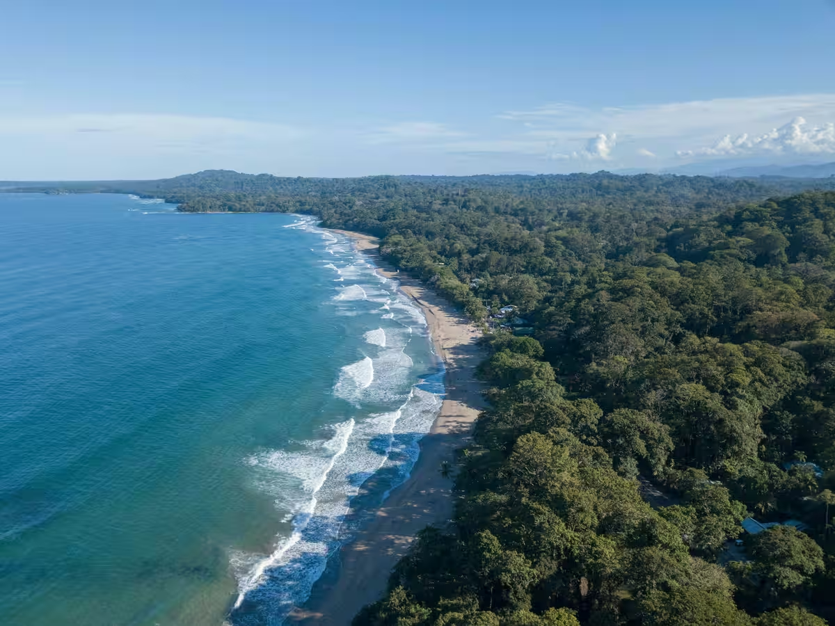
Playa Negra is one kilometer before you enter town. Past Puerto Viejo, the coastal road continues to Cocles, Playa Chiquita, Punta Uva and Manzanillo. It's a narrow road with lots of people walking and cycling at all hours, so drive slowly, especially around dusk.
Cahuita National Park is on the way, before Hone Creek. It's open every day from 8 a.m. to 4 p.m.: at the Playa Blanca entrance, in Cahuita, admission is a voluntary donation, and at Puerto Vargas you pay the SINAC fee by card.
Enterprise offices along the route
Enterprise has an office in Puerto Viejo, in the center of town, open every day from 8 a.m. to 5 p.m. Along the way there are also offices in Limón and Guápiles. If your trip starts at the airport, our San José airport (SJO) arrival guide explains how to pick up your vehicle and head out to the main routes.
Have any questions left?
These are the most common questions related to this topic. If you have a specific question, feel free to contact us: our team will be happy to help.
Between 4 and 5 hours via Route 32 and Route 36, depending on traffic and the weather in the mountains. If Route 32 is closed and you have to go through Turrialba, the trip takes longer. If you're starting from Juan Santamaría airport, our San José airport (SJO) arrival guide explains how to reach the main routes.
Take the alternative route through Cartago and Turrialba (Route 10) to Siquirres, where you rejoin the highway to Limón. It's longer and has more curves. Check the road status on Waze, Google Maps or the MOPT and Conavi updates before leaving the Central Valley.
In September and October. According to the National Meteorological Institute, the southern Caribbean doesn't have a dry season like the Pacific: it rains all year, with peaks in July and December, and the lowest rainfall falls in September and October.
No. The last one is in Hone Creek, at the turnoff to Puerto Viejo. Fill up there before continuing to town or on to Manzanillo.